祁连山,Qilian Mountains
1)Qilian Mountains祁连山
1.Analysis of the Spatial and Temporal Changes in Soil CO_2 Efflux and Its Related Factors from Alpine Meadow inQilian Mountains;祁连山高山草甸土壤CO_2通量的时空变化及其影响分析
2.Formation conditions of gas hydrates in permafrost of theQilian Mountains, Northwest China.;祁连山多年冻土区天然气水合物的形成条件
3.Design on Evaluate Indicator System of Eco-environment Quality inQilian Mountains;祁连山区生态环境质量评价指标体系的构建
英文短句/例句
1.and ends at the foot of the snow-covered Qilianshan and Tianshan mountains.西至白雪皑皑的祁连山和天山山脚。
2.THE BASIC CHARACTERISTICS OF CAMBRIAN MARINE VOLCANIC ROCKS IN THE NORTHERN QILIAN MOUNTAINS北祁连山寒武纪海相火山岩基本特征
3.An Afforestation Experiment on the Arid Area of North Hillside in East Part of Mountain Qilian祁连山东段北坡干旱浅山区造林试验
4.A Study on Mountain Climate in the Basin of Xiying River at the East Section of the Qilian Mountain;祁连山东段西营河流域山地气候研究
5.THE STUDY OF SUSTAINABLE DEVELOPMENT OF ECOLOGICALLY ECONOMIC SYSTEM IN QILIAN MOUNTAINS --A case of Qilian County Qinghai Province;祁连山区生态经济系统可持续发展研究——以青海省祁连县为例
6.a big tomb in the shape of the Qilian Mountain was built to commemorate the young army commander.为了纪念他,修建了祁连山形的墓冢,
7.DUCTILE SHEARING WITHIN SUBDUCTION COM-PLEX BELT IN NORTH QILIAN MOUNTAINS CHINA北祁连山俯冲杂岩带的韧性剪切作用
8.Experiment Research on Germ Plasm Resource and Research of Gentiana Macrophylla Pall in Qilian Mountain Area;祁连山区秦艽的种质资源及利用研究
9.Research on relation between Water-heat condition and forestation of Qilian Mountains;祁连山区水热条件与造林关系的探讨
10.A Study of Forest Damages and Changes in Qilian Mountain Area in History Period;历史上祁连山区森林的破坏与变迁考
11.Observational and Simulation Study on Structure of Cloud in Qilian Mountains祁连山地形云的观测和模拟个例研究
12.Forming Mechanism and Climatic Characteristics of Rainstorm over the Qilian Mountain祁连山区暴雨的气候特征及形成机制
13.The Spatial and Temporal Variations of Snow Cover over the Qilian Mountains Based on MODIS Data基于MODIS的祁连山区积雪时空变化特征
14.Vegetation landscape pattern and its fragmentation on southern slope of Qilian Mountain.祁连山南坡植被景观格局及其破碎化
15.Gas Hydrates in the Qilian Mountain Permafrost,Qinghai,Northwest China青海祁连山冻土区发现天然气水合物
16.THE WETLAND RESOURCES AND ITS SUCCESSION TENDENCY ANALYSIS OF QINGHAI QILIAN MOUNTAIN AREA青海祁连山湿地资源与演化趋势分析
17.Characteristics of Climate Change in Qilian Mountains Region in Recent 50 Years近50年来祁连山区气候变化特征研究
18.Northwest-to-Southeast Mountain Ranges, including the altay, Qilian and Gangdise Ranges;西北-东南走向:阿尔泰山、祁连山、冈底斯山等。
相关短句/例句
Qilian Mountain祁连山
1.Ecological Resilience ofQilian Mountain Nature Reserve.;祁连山自然保护区生态承载力分析与评价
2.Beneficial Prediction and Assessment of Cloud and Air Water Resource Exploitation over theQilian Mountain;祁连山空中云水资源开发利用效益预测与评估
3.Temporal heterogeneity of soil moisture under different vegetation types inQilian Mountain;祁连山浅山区不同植被类型土壤水分时间异质性
3)Qilianshan祁连山
1.Pb and Nd Isotopic Compositions of Basement and Granitoid in theQilianshan: Constraints on Tectonic Affinity;基底岩系和花岗岩类Pb-Nd同位素组成限制祁连山带的构造属性
2.species belonging to 17 families Hymenoptera natural enemies of insects are investigated in GansuQilianshan National Nature Reserve, in this paper.本文报道甘肃祁连山国家级自然保护区膜翅目 (Hymenoptera)天敌昆虫 1 7科 88种。
3.species belonging to 7 families Diptera natural enemies of insects are investigated in GansuQilianshan National Nature Reserve, in this paper.本文报道甘肃祁连山国家级自然保护区双翅目 (Diptera)天敌昆虫 7科 63种。
4)Qilian Mts祁连山
1.Permafrost Distribution in the Dabanshan Pass Section of Ning-Zhang Highway in EasternQilian Mts.;祁连山东段宁张公路达坂山垭口段的冻土分布
2.Wild Flowers Resource and Its Utilization inQilian Mts.;祁连山野生花卉资源及其开发利用
3.Hydrochemical Characteristics and Evolution of Runoff at Qiyi Glacier,Qilian Mts.;祁连山七一冰川融水化学组成及演化特征
5)the Qilian Mountain祁连山
1.Study on the Assessing Model of Stability of the Mountainous Ecosystem inthe Qilian Mountain;祁连山山地生态系统稳定性评估模型
2.Characteristics of Soils and Land Suitability in the WesternSegments ofthe Qilian Mountain and the Hexi Corridor;祁连山及河西走廊西段土壤和土地适宜性特征
3.By analyzing spectrum characteristics of snow,clouds and different land covers inthe Qilian Mountain region based on MODIS data from July to March ,a new method for snow discrimination is presented on the basis of former researches,which combined NDSI(Normalized Difference Snow Index) and band 18,band 31 of MODIS to discriminate snow from clouds,saline,ice,desert,etc.对祁连山区积雪、云和各种下垫面进行光谱分析,利用7月至3月的MODIS数据资料,在前人所做研究工作的基础上提出利用归一化差值积雪指数NDSI(Normalized Difference Snow Index)和中分辨率成像光谱仪(Moderate Resolution Imagigng Spectroradiometer)的band 18和band31的结合,采用逐步逼近法去除大部分云、盐湖、冰面、沙漠、戈壁等对积雪判识的干扰,从而判识出祁连山区积雪。
6)North Qilian mountains北祁连山
1.SHRIMP U-Pb Geochronological Research on Detrital Zircons from the Beidahe Complex-Group in the Western Segment of the North Qilian Mountains, Northwest China;北祁连山西段北大河岩群碎屑锆石SHRIMP U-Pb年代学研究
2.Reconstruction of protoliths of metamorphic rocks and tectonic setting of the Haiyuan Group in the Haiyuan in the eastern segment of the North Qilian Mountains, China.;北祁连山东段海原一带海原群变质岩原岩恢复及其构造背景
3.Chronology and Geological Significance of Chelugou Dacite Porphyry in North Qilian Mountains;北祁连山车路沟英安斑岩的年代学及地质意义
延伸阅读
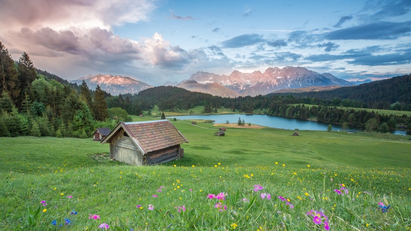
祁连山祁连山Qilian ShanQiliQn Shan祁连山(Qilian shan)中国青藏高原东北边缘山脉。匈奴语呼天为“祁连”,故名。位于青海、甘肃两省交界处。西起当金山口与阿尔金山山刀永相接,东至黄河谷地与秦岭、六盘山相连,南抱柴达木、共和盆地,北临河西走廊。亦称走廊南山。东西长达1 000千米,南北宽200一300千米,面积20.6万平方千米。由一系列西北一东南走向的平行山脉和山间谷地组成。地势西北高、东南低,北坡陡峻,南坡和缓。山峰海拔多在4 000米以上,最高峰为疏勒南山团结峰(又名宰吾结勒),海拔5 808米。山体多由石灰岩、花岗岩组成。海拔4 500米以上的山峰终年积雪,冰川广布。祁连山由西向东分为三段。西段为疏勒河上游谷地以西。自北至南有照壁山、大雪山(野马山)、野马南山、党河南山、察汗鄂博图岭、土尔根达板和柴达木l一日。山势高峻,海拔多在3 500~5 000米之间,主峰大雪山海拔5 483米。大部山坡植被稀疏,阴坡生长小片针叶林及灌木林。发源西段的疏勒河、党河,流人河西走廊。位于阿尔金山脉和祁连{妇交接处的当金山口是重要隘口,海拔3 649米,南北长约27千米,谷狭路隘,两侧山峦重迭,奇峰陡立,地势险要。柳园一格尔木公路从山口通过,是沟通河西走廊和柴达木盆地间的重要通道。距嘉峪关市81千米的镜铁山铁矿一,储量大,全国闻名。中段为疏勒河上游谷地至扁都口。由北向南有走廊南山、托来山、托来南山、疏勒南山、哈拉南山、宗务隆山、青海南山,其间夹有黑河谷地、青海湖盆地。主峰祁连山海拔5 547米。阴坡峡谷,林木茂密,生长云杉林及冷杉林,海拔4 000米以上植被稀少。北麓水源丰富。共有大小河流12条,其中黑河最大。南麓干燥,植被稀少。由西北向东南有近28个沟口,北距甘肃省民乐县28千米处的扁都口最为重要,是西宁一张掖公路之咽喉。扁都沟贯通南北,沟长32千米,谷宽仅30一200米,海拔3 200-4 150米。两侧山峰连绵起伏,多为悬崖绝壁,山坡灌木丛生,童子坝河沿沟北流。山间溪多流长,水质良好。有西宁一嘉峪关的公路经扁都口斜穿山地,是青海和一甘肃间又一通道。东段为扁都口以东。自北向南有冷龙岭、乌稍岭、大通山、拉脊山等,海拔2 400一3 500米。冷龙岭最高,海拔4 843米。海拔3 000米的阴坡、谷底,为茂密的森林和草原;3 200一4 000米为高山草原草甸及灌木林。阳坡均为山地草原。大通河由西向东流,河谷地势低平。盐矿资源丰富。青海湖为中国最大咸水湖泊,周围为良好草场,是发展畜牧业的理想地区。煤矿储量丰富,著名的有木里一江仓煤矿和九条岭煤矿。有兰州一乌鲁木齐铁路、公路南北纵穿。西段为高寒大!淤哇干旱区,中段和东段为高寒大陆性半干旱区,1月平均气温一16-一10℃,7月平均气温9一16℃。东段夏季雨水较多,中段为湿润干燥过渡区,雨量渐少,西段极端干燥。最大冻土深1.5一2.0米。祁连山山体庞大,山势险峻,为河西走廊的重要依托。(张立学)祁连山一瞥孟昭瑞摄